Hiking in Tenerife: 13 Trails with Unmatched Scenery
Written by Sergio Fomenkov
Meet Sergio! A travel enthusiast with a zest for exploration, he's all about discovering Spain's beauty, especially the Canary Islands! 🏝️ As a true Canary Islands lover, Sergio dedicates his time to uncovering hidden gems and capturing stunning landscapes that make this paradise so unique. He combines his love for adventure and in-depth knowledge of the region to inspire fellow travelers and help them create unforgettable memories on their journeys through the Canary Islands and beyond! Follow Sergio on Instagram, Facebook, LinkedIn, and WikiData. ... show more
The largest island in the Canary Archipelago, Tenerife, welcomes guests with a consistently mild climate and a clear ocean. A mountain range featuring the majestic Teide volcano divides the island into a humid north, boasting rich vegetation, and a sunny, dry south, where there is practically no rain.
No surprise that Tenerife is a year-round paradise for hiking and trekking enthusiasts. There are numerous epic routes on the islands, all of which are well marked and equipped.
Key takeaways
- Climb (or detour) Mount Teide: It is something that you will probably remember for the rest of your life
- Be prepared: Hiking to Mount Teide offers heat, cold, snow, rain, wind, and lots of UV
- Looking for some easier trails? Almond Blossom Trail, Barranco de Masca, Anaga Park, and Barranco del Infierno are very pleasant and easy hikes.
- Best time to visit Tenerife is from April through the end of October.
What people say on Reddit
Just fill up before you go 🙂 No problems with running out of petrol.
Besides the obvious recommendations one can find with few minutes of googeling – if the island is completely new to you and you don’t have a time pressure (short holiday vs. longer remote work stay), then I think you already know the answer. Just drive somewhere random and go for it. You will love it. I personally could spend days just wandering around the Teide National Park plateau. Just don’t underestimate the weather (wind + temp) and keep in mind there is no phone reception.
mrpi31459
I had a great time there last year in winter. Nice to see the scenery again. Make sure to hear into Anaga, beautiful around sunset.
searching-freedom
I went to Tenerife three years ago, mostly hiked there and went to see smaller cities, I did not do one single over crowded touristic place and it was amazing, one of my favourite places I’ve visited, there’s definitely an other side to the island.
atchoum013
Tenerife is an amazing place. There is a great hike called Mazca. You start at a restaurant and go down in the canyon gradually until you arrive at a massive opening towards the ocean. A beautiful and warm beach of black volcanic sand welcomes you.
popotheviking
Best Hiking Trails in Tenerife Map
Useful Video
Now, let’s start our journey from the western part of the island.
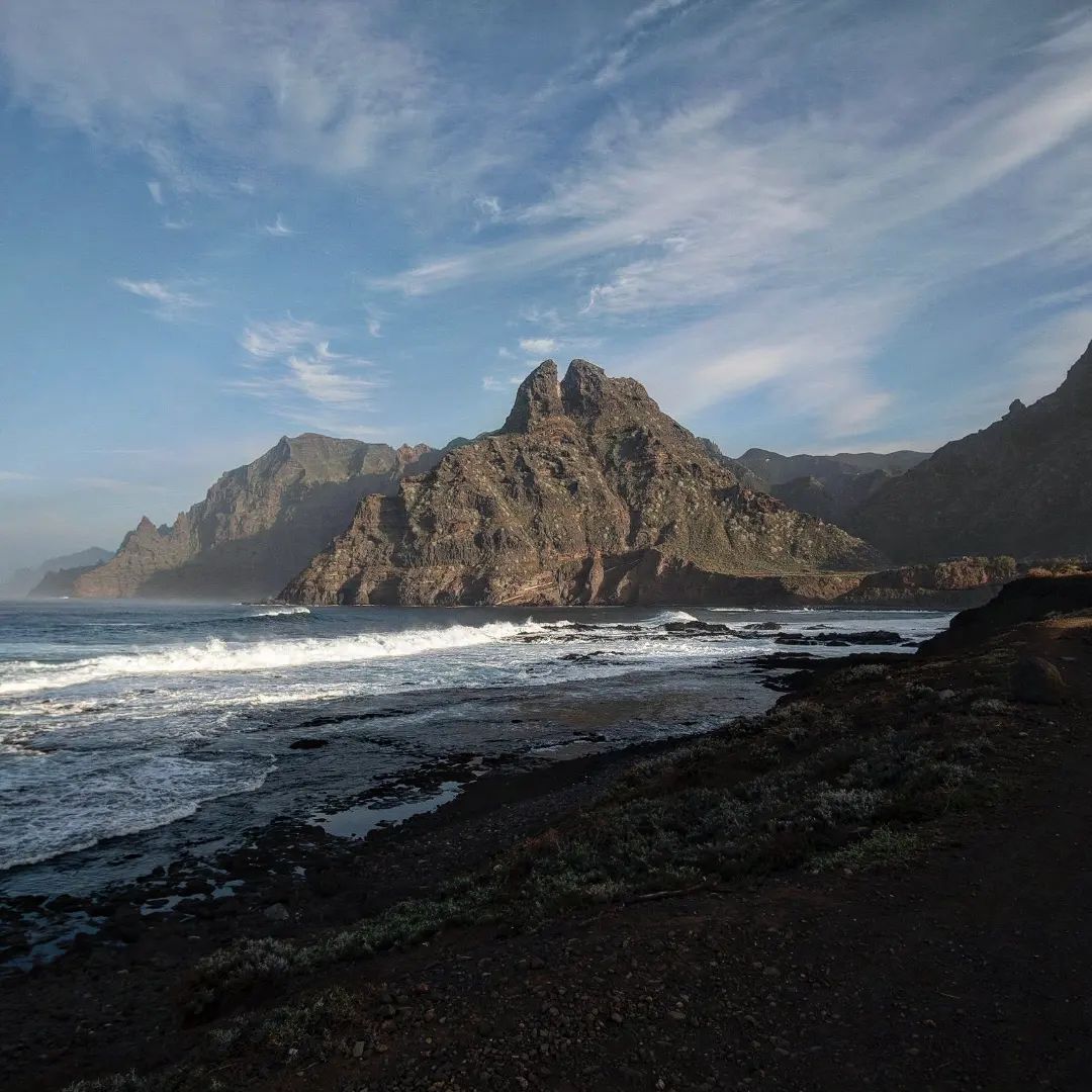
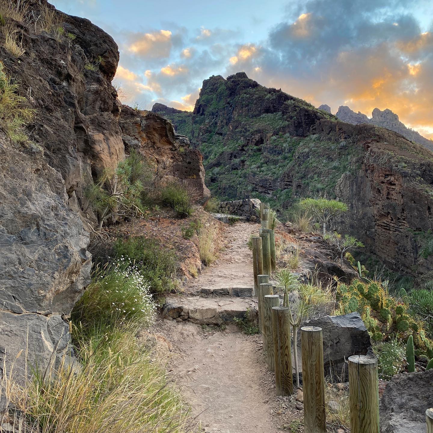
1. The Masca Gorge – Tenerife’s Most Popular Hiking Trail
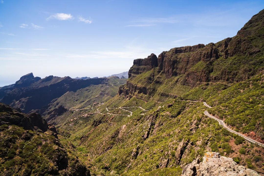
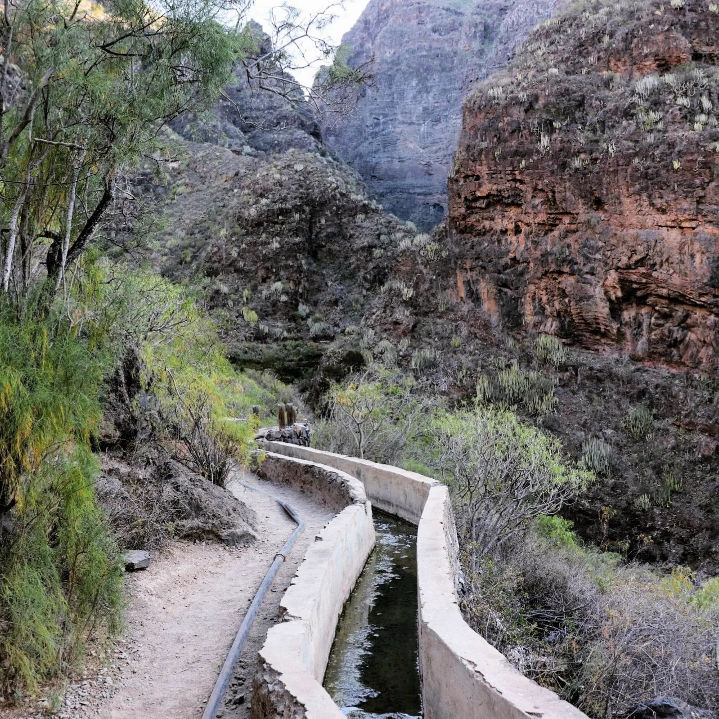
The Masca Gorge (Barranco de Masca) is a picturesque trail with stunning views and access to the Atlantic Ocean. Travelers are transported to the beginning of the route by taxi from the port of Los Gigantes, where they need to purchase a boat ticket. Before starting the descent, tourists make a stop at the scenic village of Masca.
The descent then follows a stream that flows into the ocean. The banks are overgrown with lush endemic vegetation, and the steep walls of the gorge tower hundreds of meters above the trail on both sides. After 3-4 hours, tourists reach a rocky beach where they can swim in the ocean before the boat arrives.
You can traverse the Masca route independently, as a guide is not required. Be sure to wear suitable footwear.
| Public transportation | From Las Americas, take bus line No. 460 to Santiago del Teide, then transfer to bus line 355 to the village of Masca. |
| Distance | 3.1 miles (5 km) |
| Duration | 3-4 hours |
| Difficulty | Medium |
| Elevation change | 2,000 feet (600 m) |
2. Almond Blossom Trail

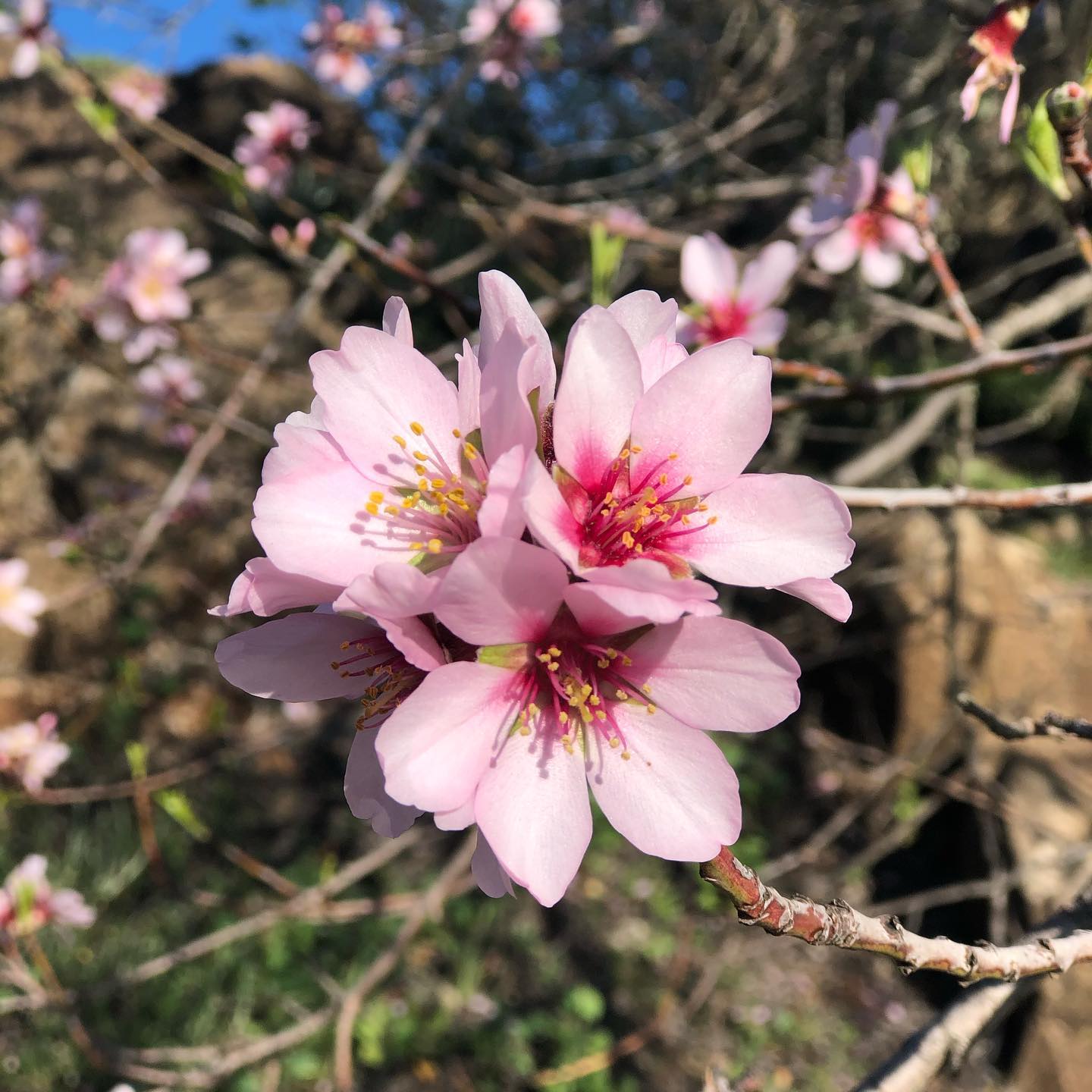
If you are not up for the challenge of the Masca Gorge, there is an easy and delightful route nearby among flowering almond trees and fresh lava. In Santiago del Teide, where the turn to the Teno Mountains and the Masca Gorge is, the famous Ruta De Los Almendros trail begins.
The walk starts in Santiago del Teide, at Plaza de la Iglesia, and meanders through the Las Manchas area before ending in the town of Arguayo. Altogether, it is a 5.6-mile (9-kilometer) walk of intermediate difficulty. There is a shorter version of the route that begins at El Calvario de los Baldios in Valle de Arriba and also ends in Arguayo.
| Public transportation | From Las Americas or Costa Adeje, take bus line No. 460 to Santiago del Teide, which takes approximately 1 hour and 30 minutes. |
| Distance | 5.6 miles (9 km) |
| Duration | 3-4 hours |
| Difficulty | Medium |
Read also: A Complete Guide to Lanzarote – Volcano, Beaches, and Hidden Gems
3. El Bujero
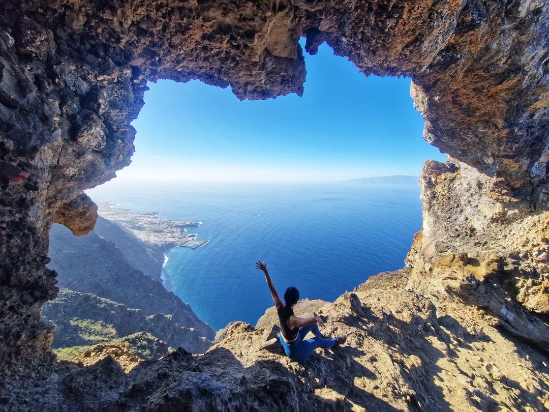
El Bujero is a challenging hike that leads to a rock gate at an incredible height above Los Gigantes. By bus (or “Guagua,” as they are called here), you will arrive at a village called Tamaimo, near Los Gigantes, and will look for the beginning of the hike. Tamaimo is a beautifully constructed Canarian village with charming houses, narrow streets, and a lovely square with trees and a church. Mountains surround Tamaimo, and you will be heading to the top of one of them.
The place itself is very high, and the clouds are within reach. I won’t lie, the height can be a bit intimidating, so you should be very careful when moving under the rock gate and when taking photos. On the other hand, sitting inside this rock formation is an incredible experience, and I can only recommend this trip in Tenerife to all adventurers!
Set aside at least half a day for this trip – length approximately 5 hours round trip, with breaks (it took us about 7 hours).
| Public transportation | You can get to Tamaimo by bus No. 460 (from Costa Adeje Central bus station in the direction of Icod de Los Vinos). The journey takes about 50 minutes. |
| Distance | 6.8 miles (11 km) |
| Duration | Approximately 5 hours round trip, with breaks (it took us about 7 hours) |
| Difficulty | Medium |
| Elevation change | 1,542 feet (470 m) |
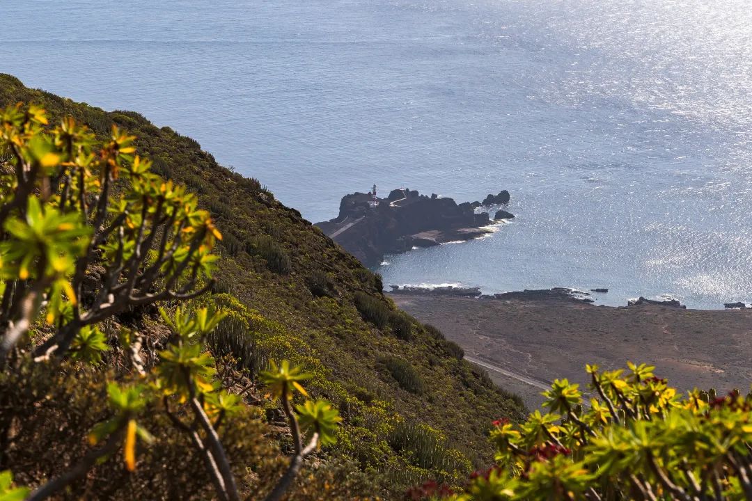
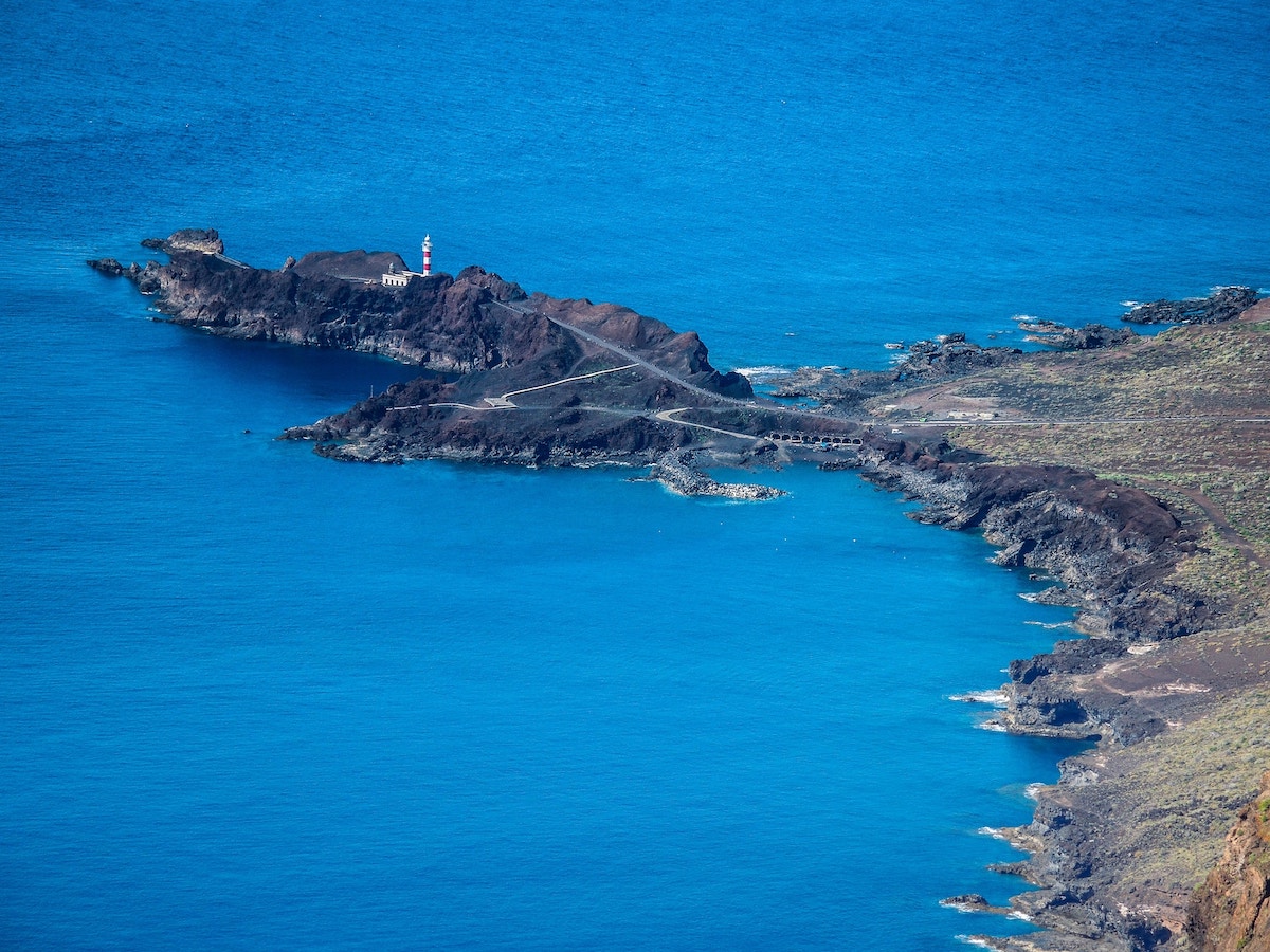
4. Teno National Park & Water Mountain
The route around Water Mountain is rightfully included in my ranking of the best hikes in Tenerife.
A little about the place: It is one of the most remote locations on the island and therefore boasts a well-preserved natural site. Teno is rarely visited by tourists, with the exception of Masca Gorge. There is a unique microclimate and an abundance of greenery. To reach Teno, you must navigate a narrow serpentine road with blind turns.
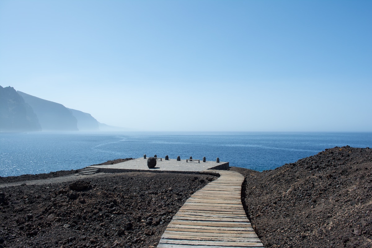
The forests of Teno National Park are little known to tourists but incredibly beautiful. For half of the route, you can simply walk, breathing in the fresh air and admiring the surrounding beauty. Additionally, the Rural Park has its most emblematic point at the Punta de Teno Lighthouse, the westernmost tip of the island.
| Public transportation | From Santiago del Teide to Buenavista del Norte, take bus line 355 and then transfer to bus line 369 to Punta de Teno. The journey takes about 1 hour and 30 minutes. |
| Distance | 6.2 miles (10 km) |
| Duration | 4-5 hours |
| Difficulty | Medium |
| Elevation change | 1,969 feet (600 m) |
Next, let’s head to the north of Tenerife…
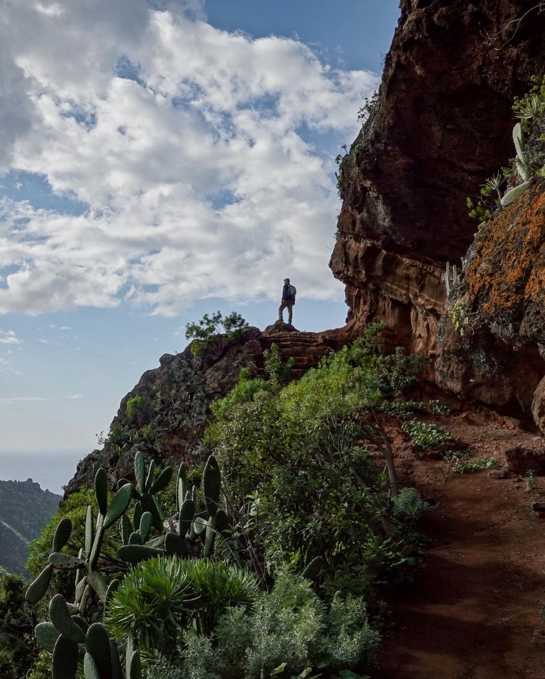
5. Anaga Park, a Route Through the North of Tenerife
The route begins with the Path of the Senses, which itself starts from the parking lot, known as Cruz del Carmen, located on Monte de Las Mercedes. In the same place, you will find the information office and interpretation center of the Anaga Rural Park, where you can obtain more details, directions, and maps.
This path, one of the oldest on the island, begins its journey in the Cruz del Carmen equipment area, specifically to the right of the Hermitage of Nuestra Señora del Carmen. It advances about 98 feet (30 meters) along a forest track before continuing along a dirt road embedded in the terrain. The elevation change of the route is a legacy of the water channel that used to run along the same path.
This section is framed by an environment of typical vegetation, such as fayas, heather, and some species characteristic of the laurisilva, and reaches Llano de Los Loros, from where it is possible to enjoy expansive panoramas of the North coast. From here, the path widens until it ends at a curve of the TF-12 road.
To continue the route, it is necessary to cross the road and follow the dirt road, which leads to Llano de Los Viejos.
| Public transportation | Take buses No. 76 or 275 from the Intercambiador Laguna bus station to Cruz del Carmen. The journey takes approximately 20 minutes. |
| Starting point | Cruz del Carmen |
| Point of arrival | Llano de Los Viejos |
| Recreational Area Distance | 0.93 miles (1.5 km) |
| Duration | 45 minutes |
| Difficulty | Low |
| Elevation change | 246 feet (75 m) |
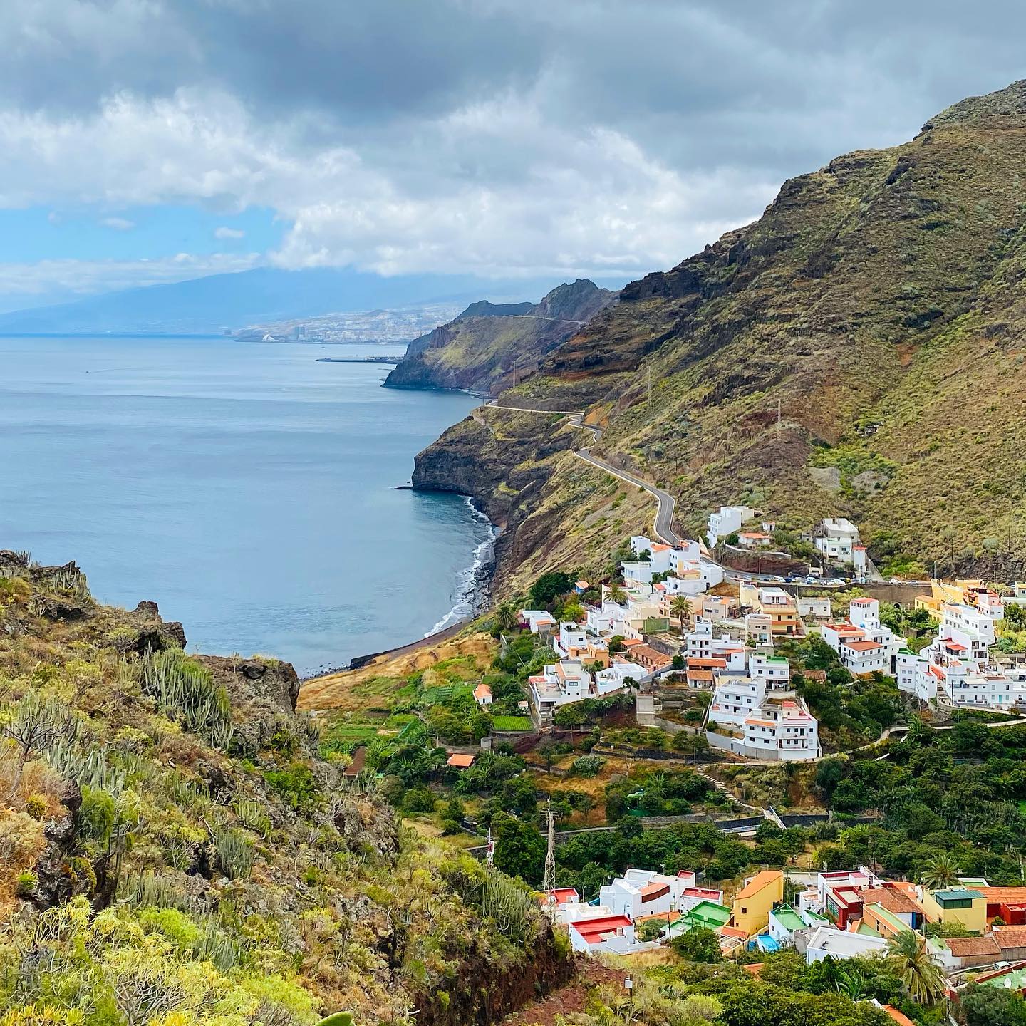
6. Roque de Taborno
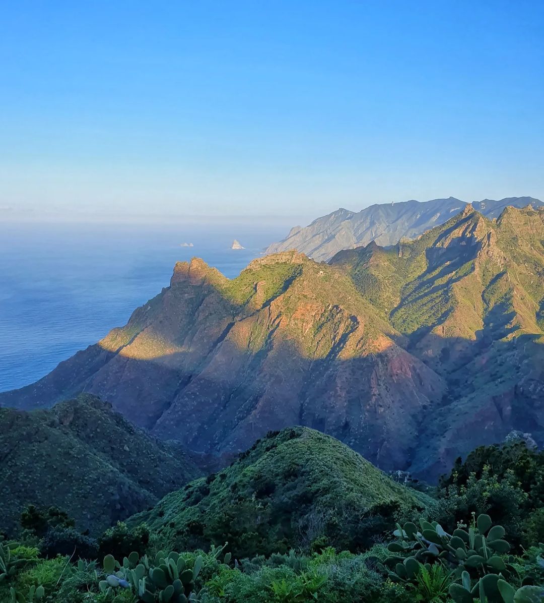
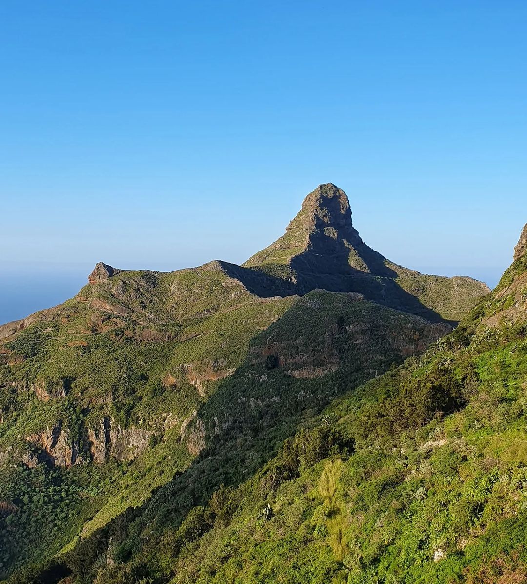
Taborno is a town belonging to the municipality of Santa Cruz de Tenerife, located on the northern slope of the Anaga Massif. The most iconic route there is Roque de Taborno, an impressive area situated between the city and the coast, well worth a hike.
The trail to Roque de Taborno is not difficult, but make sure to wear good shoes as you will be traversing rocks. But before that, you’ll can have a lunch at a fantastic restaurant with a French chef, “Historias Para No Dormir.” The menu of the day costs approximately $18, and everything is delicious.
All right, now let’s head to the trail. The round trip distance is about 2.5 miles (4 km). The path leads up to Roque de Taborno, the mountain itself being the symbol of Anaga Park. At the very end is the striking observation deck, Era de los Cardos, from which you can see most of the northern coast and even Benijo Beach.
| Public transportation | Take bus No. 275 from the Intercambiador Laguna bus station to Taborno. The journey takes approximately 50 minutes. |
| Starting point | Taborno |
| Point of arrival | Roque de Taborno |
| Distance | 2.5 miles (4 km) |
| Duration | 1 hour |
| Difficulty | Medium |
| Elevation change | 361-2,316 feet (110-706 m) |
7. Barranco del Rio
The next interesting hike near Taborno is Barranco del Rio. The starting point is the small village of Chinamada.
From Chinamada, you can reach the viewpoint of Aguaide, about 1,312 feet (400 meters) above the rocks, at one of the most beautiful points in Tenerife.
In addition to the Anaga Mountains, you can also see the town of Punta del Hidalgo, the beginning and end of our journey. In the northeast direction, the peak of the iconic Monte Taborno stands out.
The descent back is challenging, as usual, but the beauty of Barranco del Río is rewarding even after the sunset.
| Public transportation | If you are already in Taborno, you can also visit Barranco del Rio and take the same bus No. 275. It is located 2 stops from Taborno. Take bus No. 275 from the Intercambiador Laguna bus station to Las Carboneras and walk 1.6 miles (2.5 km). The journey takes approximately 50 minutes by bus and 30 minutes on foot. The total journey takes approximately 1 hour and 20 minutes. |
| Starting point | Chinamada |
| Point of arrival | Punta del Hidalgo |
| Recreational Area Distance | 2.9 miles (4.7 km |
| Duration | 2 hours and 15 minutes |
| Difficulty | Medium |
| Elevation change | 3,198 feet (974 m) |
Our next route is located in the northeast of the island…
8. El Semáforo de Igueste de San Andrés
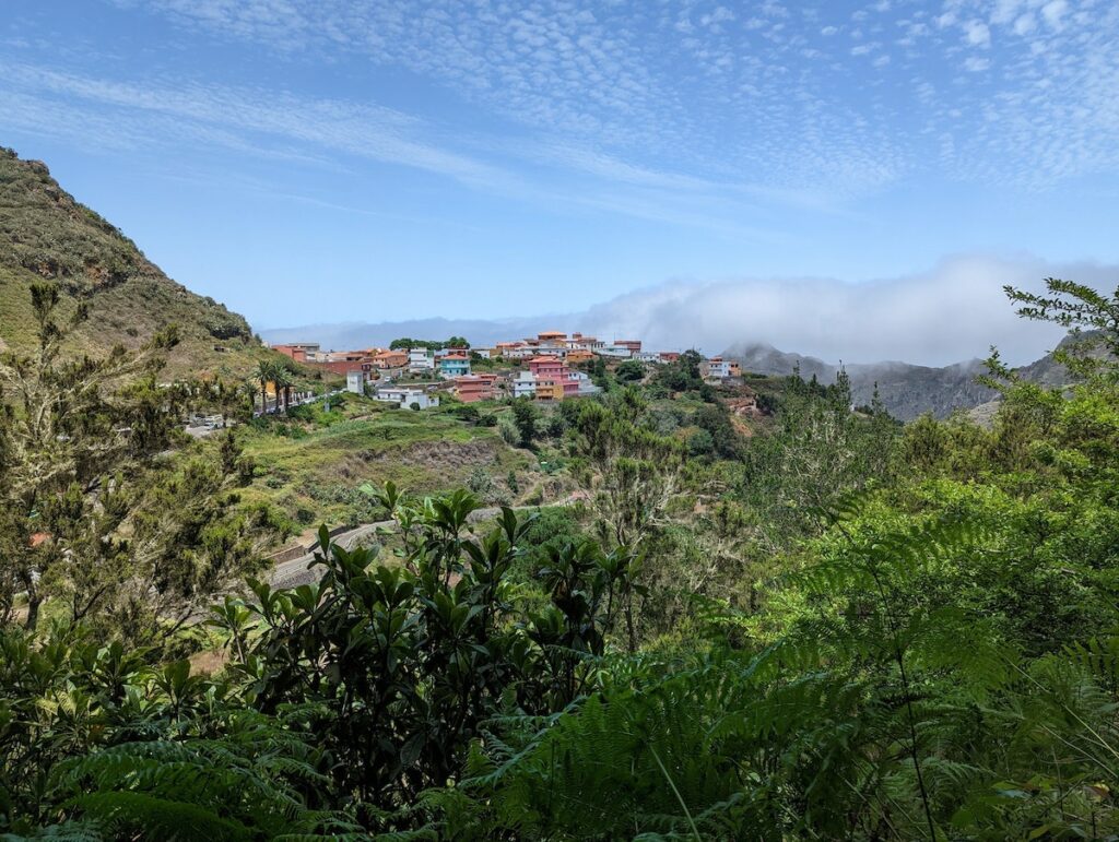
Igueste de San Andrés, where the route begins, is a tiny village with just over 500 inhabitants. It is located a 12-15 minute serpentine drive past the village of San Andres and Las Teresitas beach.
The trail starts from the Church of San Pedro itself. Strolling through the characteristic streets of Igueste de San Andrés, you will find indications on where to continue the trail.
The so-called “Semaphore” of San Andrés was a building that served as a lighthouse to indicate the arrival of ships from the north of Tenerife. This building was used until the end of the 80s, after which it fell into oblivion, leaving an abandoned structure. Due to its precarious state, it is not recommended that you enter the building.
Behind the Semaphore, you can see the very tip of Anaga – the picturesque Cape Antequera (Punta de Antequera) and the beach of the same name. On foot, you still need to overcome one more pass, and many go in one direction, returning back by boat.
| Starting point | Igueste de San Andrés |
| Point of arrival | The Traffic Light |
| Path Type | Linear |
| Distance | 1.4 miles (2.2 km) |
| Duration | 1 hour |
| Difficulty | Low |
| Elevation change | 49-1,165 feet (15-355 m) |
9. Special Nature Reserve of Malpaís de Güímar
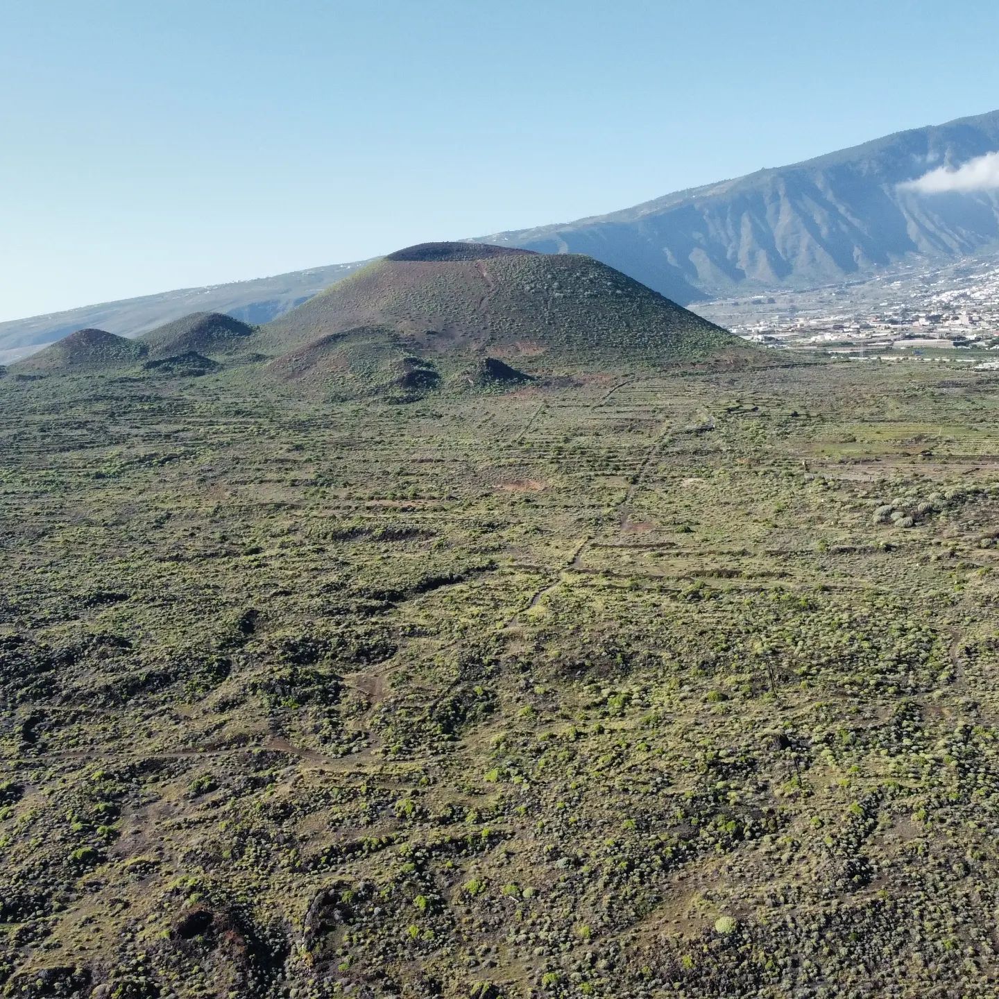
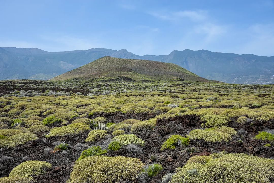
Its landscapes are reminiscent of scenes from science fiction films. The reserve is located on the east coast of the island, between the towns of Puertito de Güímar and El Socorro. The starting point of the route can be either of these cities. Entrance to the territory of Malpaís de Güímar is free.
The almost bare surface of the earth is combined with the black color of lava interspersed with reddish sand. It all looks like another planet.
And the plain itself changes color from bright brown to black. Moreover, the black porous volcanic rock reaches the very ocean and creates an incredible visual contrast with the water surface.
I suggest starting your walk through the reserve from Puertito de Güímar. You can leave the car on the outskirts of the city and then follow the path towards the ocean.
A full inspection of the territory of Malpaís de Güímar and a short rest on the beach can take half a day. But the lava valley is worth it.
I definitely recommend this place for the nature and long walks. In addition, the weather is always good here, even when it is cloudy and raining in other parts of Tenerife.
| Public transportation | The bus No. 111 from bus station Costa Adeje to Camino del Sacorro and walking 1.2 miles (2 km). The journey takes approximately 1 hour by bus and 20 minutes of walking. |
| Recreational Area Distance | 0.93 miles (1.5 km) |
| Duration | 3-6 hours, depending on the route |
| Difficulty | Medium |
| Elevation change | 400 feet (122 m) |
Instagram Review
Now let’s get to the center of Tenerife and its most famous point, Teide National Park.
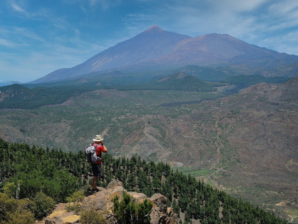
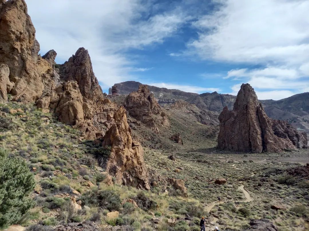
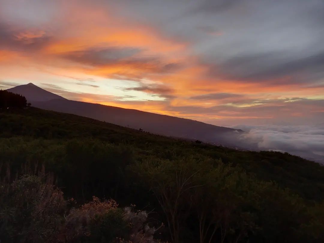
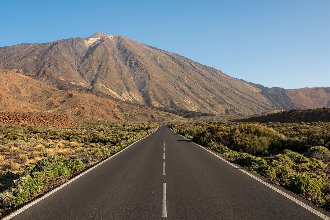
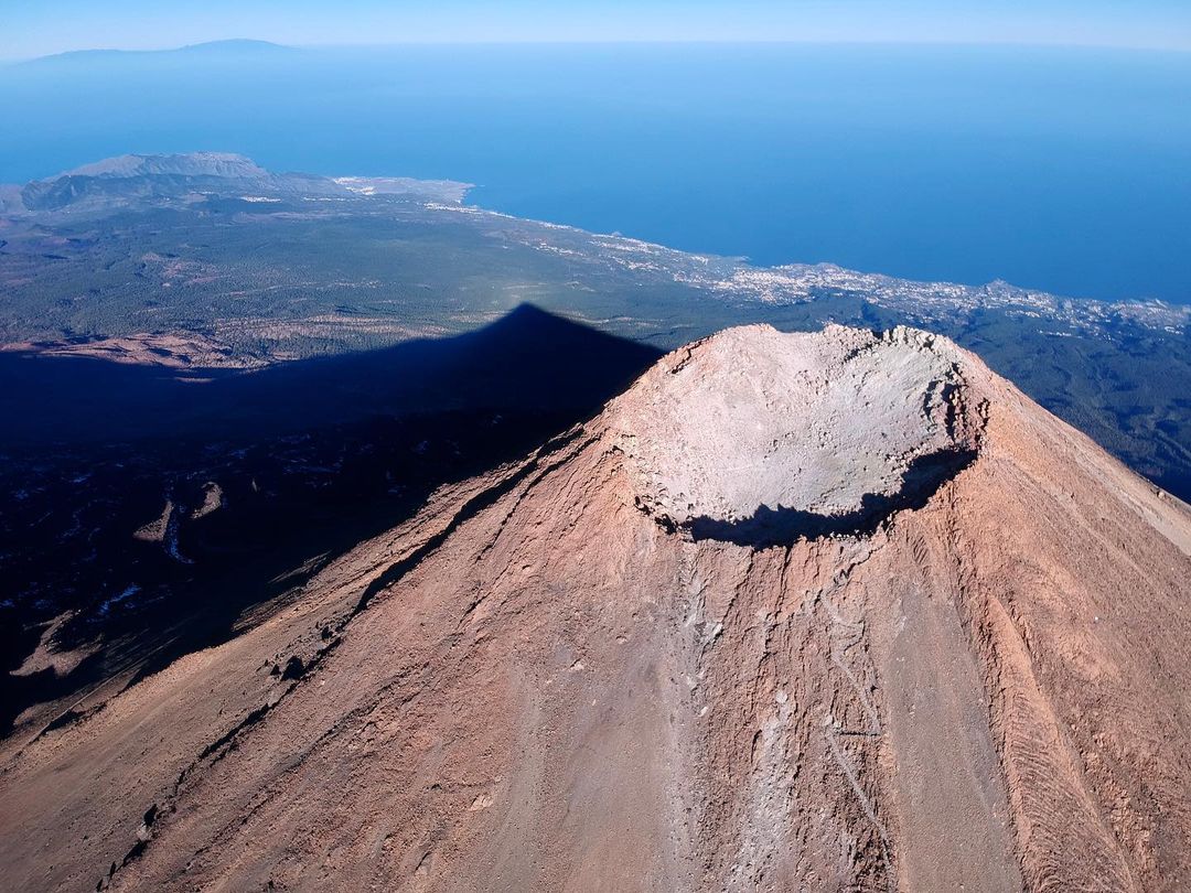
10. Mount Teide
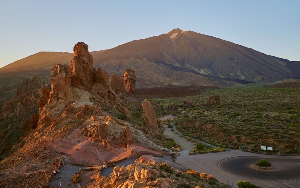
Teide National Park in Tenerife is rightfully considered the most famous attraction of the island.
Also, the Teide peak with its 12,198 feet (3,718 meters) height above sea level is the highest point in Spain.
You can climb the volcano with the help of a cable car, but it does not go to the very top. To see the Teide crater, you will have to make a walking tour, which usually takes about an hour.
Despite the availability of a cable car and an experienced guide, climbing is not an ordinary walk; it requires good physical conditions.
Today, without getting out of the car, you can climb to 7,729 feet (2,356 meters) – this is the height of the lower cable car station. Then either by funicular for €27 (the cost of a round-trip ticket), or on foot for free. The funicular will take you to the 11,660 feet (3,555 meters) mark in eight minutes.
By purchasing tickets in advance on the funicular website www.volcanoteide.com, you are guaranteed to save yourself from the prospect of waiting in line for boarding. Tickets are sold for a specific date and time that you choose when purchasing. After purchasing tickets, you will receive an identification number with a QR code by email.
The last 535 feet (163 meters) to the summit is a restricted area, and to get to the Teide crater, you must obtain permission in advance on the website reservasparquesnacionales.es and print it out. The permit is issued free of charge. In addition to permission, you must have the passport or its photocopy.
If you use a car for the trip, then you need to fill the tank with fuel in the right amount before the trip as there are no gas stations in the Teide National Park.
Given the unpredictability of the weather, as well as the fact that it is much colder near the crater of the Teide volcano than at the foot, it is worth bringing comfortable warm clothes, a hat, and shoes with you.
Lack of a car will not be an obstacle to see the main volcano of Tenerife.
| Public transportation | The bus No. 342 from Las Americas or Costa Adeje to Teide. The journey takes approximately 1 hour and 20 minutes. |
| Distance | 5.6 miles (9 km), depending on the route. |
| Duration | 6-7 hours |
| Highest point | 7,726-12,198 ft (2,356-3,718 m) |
Peak Teide is the highest point (12,198 feet or 3,718 meters) in Spain and the Atlantic Ocean. Climbing on foot will take all day. It requires good physical shape, adequate equipment, and an understanding of what you are doing.
11. Pico Viejo
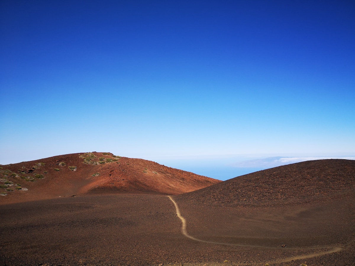
Pico Viejo (10,262 ft or 3,129 m) is a difficult but interesting route to the second highest mountain after Teide. Its crater, approximately 2,625 ft (800 m) in diameter, is one of the satellite craters distributed around Mount Teide.
From the lookout, you can admire the Pico Viejo volcano. At first glance, it can be confused with Teide, but Teide is not visible from here.
The ascent will take approximately 5-6 hours. Only from above does the crater of the Pico Viejo volcano reveal itself. It feels like you are on Mars!
As a result, I reiterate that the road is difficult; you have to wear sturdy trekking shoes.
There is also an option to take the funicular to the upper station, from where, in addition to the trail to the crater, there are two more routes: one to the right and one to the left around the summit. Both are about 30 minutes long.
Most people who take the funicular to the crater do not go further. Being at an altitude of 11,483 ft (3.5 km) is an extraordinary event in itself.
Helpful tip Do not forget to bring enough water with you – at least 1 quart (1 liter) per person. Take food as well.
| Starting point | La Rambleta – Viewpoint of Pico Viejo |
| Arrival point | Viewpoint of the Nose of Mount Teide |
| Distance | 5.8 miles (9.3 km) |
| Duration | 5-6 hours, depending on the level of training |
| Elevation change | 6,716-11,476 ft (2,048-3,498 m) |
And finally, we explore the southern tip of Tenerife…
12. Lunar Landscape (Paisaje Lunar)
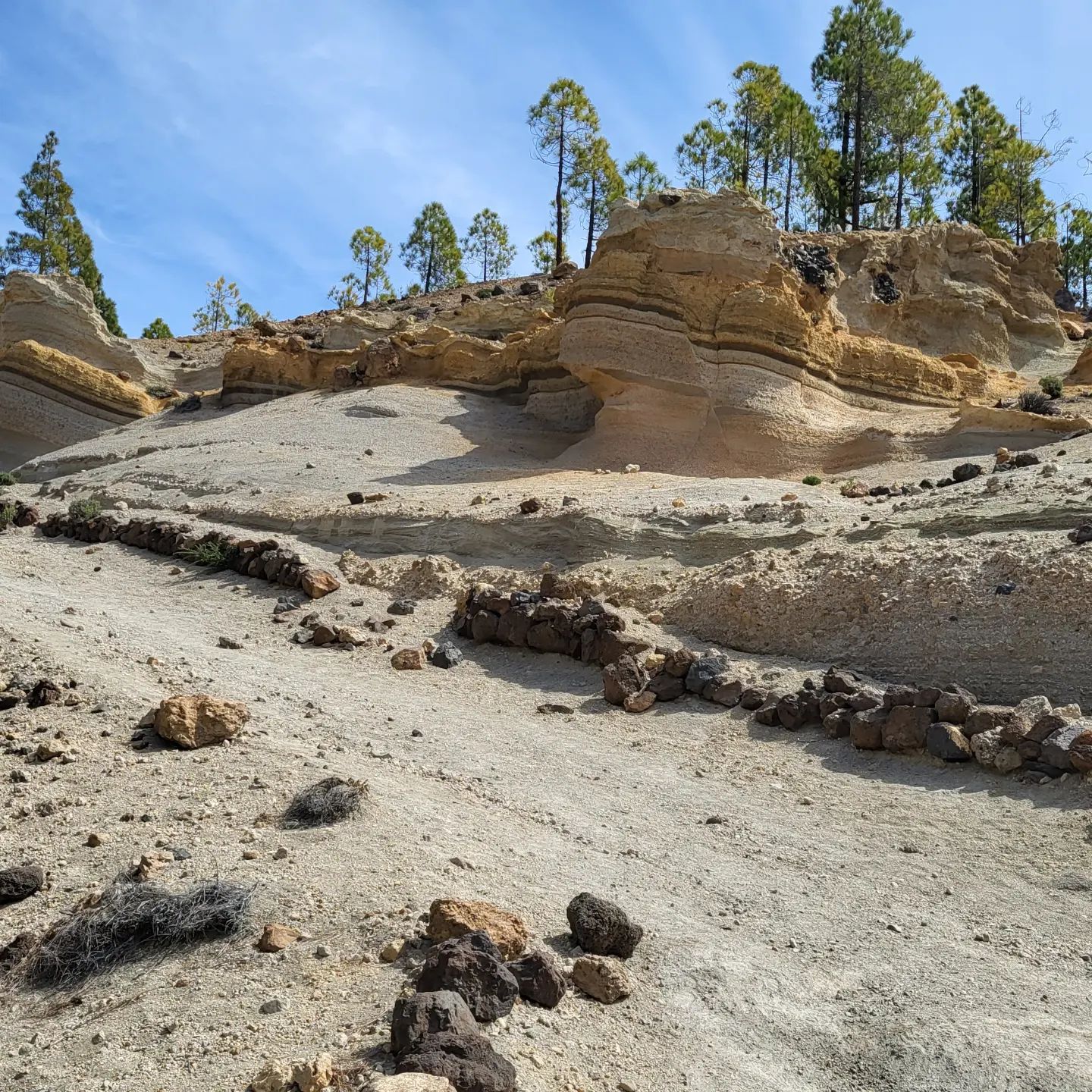
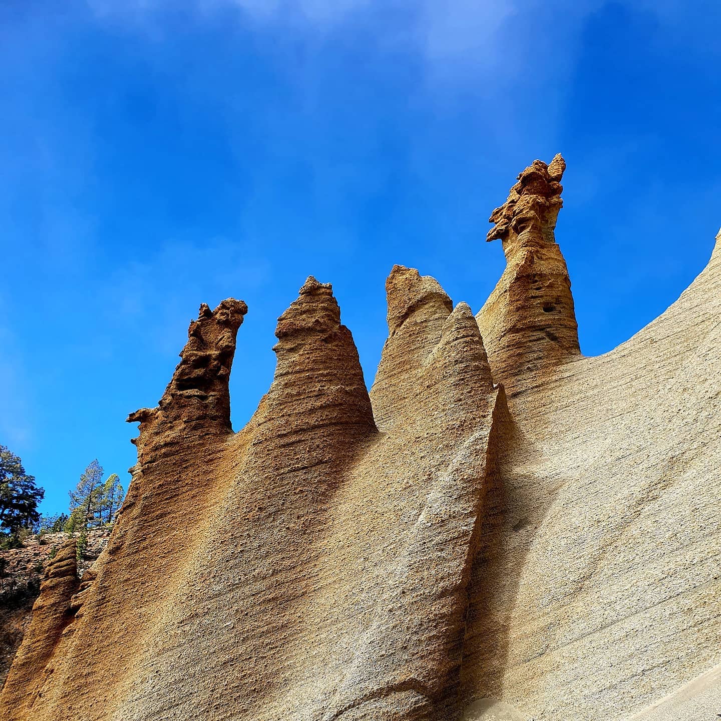
The classic Tenerife route to the Lunar Landscape from Vilaflor village is very beautiful and simple; it is easily managed by retirees. This unusual mountain formation is located on the southern slope of the ridge that surrounds the Teide caldera.
The landscape of Paisaje Lunar truly appears otherworldly. Whimsical stone waves and polished cones seemingly glow against the backdrop of dark volcanic slopes, picturesque wastelands, and blue skies. These figures are carved by nature itself from porous, light tuff, once expelled by an eruption.
| Public transportation | Take bus No. 482 from Los Cristianos to Santa Catalina. The journey takes approximately 35 minutes. |
| Distance | depending on the starting point: from 7.5 to 8.7 miles (12 to 14 km). |
| Duration | 4-6 hours, depending on the level of training. |
| Difficulty | Medium |
| Elevation change | 4,593-6,562 ft (1,400-2,000 m) |
13. Hell’s Gorge Infierno Natural Park (Barranco del Infierno)
The walking route is divided into 12 stages. It passes along the left edge of the gorge, winds down to the bottom of the gorge, leads to the spring through tropical thickets, and ends at the waterfall. There is no further path; it is a dead end. The waterfall looks absolutely fabulous, with a height of more than 656 ft (200 m), and it is a must-see!
When planning a walk in Barranco del Infierno, be sure to wear comfortable shoes for crushed stone and rocks, a hat, and bring a supply of water.
It is advisable to dress warmly or at least bring something warm during the winter months or cloudy days, as the temperature drops when you climb the mountains due to winds and the lack of sun in the crevices.
To visit Infierno, it’s best to reserve a spot in advance on the official website (barrancodelinfierno.es).
| Public transportation | Take buses No. 473 or 447 from Las Americas or Costa Adeje to Teide. The journey takes approximately 45 minutes. |
| Distance | About 2.5 miles one way (5 miles total, or 4 km one way, 8 km total). |
| Duration | 4 hours, depending on the level of training |
| Difficulty | Easy |
| Elevation change | 820 ft. (from 2,297 ft. to 1,476 ft., or from 700 m to 450 m) |
Tips on Hiking in Tenerife, Spain
Finally, I want to give you some tips so that you can avoid any setbacks and fully enjoy your time on some of the island’s trails.
- It is important, especially if you are going for a walk in the summer, to bring a bottle of water with you because sometimes heat is common during certain seasons, and it is always crucial to stay well hydrated.
- Use the marked trails to avoid getting lost. There are many trails on the island of Tenerife, and most of them are well marked. If you are a tourist and do not know the area well, please do not make the mistake of venturing onto unmarked routes. You should always follow the instructions.
- Before you start on your chosen route, gather information, especially at tourist information points, where you can be provided with details about the route you want to take and the precautions you should follow.
- Always wear the right shoes for these walks. Sometimes you may encounter more difficult paths where you should be especially careful, or even wet areas where it will be easy to slip. With proper footwear, we can avoid problems on hikes.
- Do not enter caves that are not marked or are not intended for hiking. As you know, Tenerife is a mountainous island and has an extensive network of tunnels and caves, some of which are not suitable for walking and can even be dangerous due to circulating volcanic gases, which are poisonous and can be very hazardous. Sometimes, you may not even realize that you are inhaling harmful gases.
- Always carry a mobile phone with you, just in case you get lost or something unexpected happens despite taking all precautions.
Best Apps for Hiking in Tenerife
Read also: Best Hiking Apps for Android & Best Hiking Apps for iPhone
Best Places to Stay in Tenerife for Hiking
- La Laguna and Santa Cruz de Tenerife to explore Anaga Rural Park and northern part of the island.
- Buenavista del Norte or Los Silos for Teno Rural Park
- Santiago del Teide or Los Gigantes for Teno Rural Park and Teide National Park
- Vilaflor for exploring Teide National Park
- Arona for exploring Teide National Park and the South Coast
My Other Posts About Tenerife
