11 Hardest Hikes to Try in Arizona in 2026
Written by Nadia Podrabinek
Hello, my name is Nadia. I usually write about traveling (there are so many places to fit all the lifestyles), relocation, and living in a foreign country (adapting to a different culture). My travels stretch beyond Spain, with journeys to the US, Italy, Norway, Portugal, and France. Relocating to Spain in 2018, I lived in cities from Barcelona to Madrid, currently calling Valencia home. Follow me on Twitter, Facebook, Instagram, or LinkedIn! ... show more
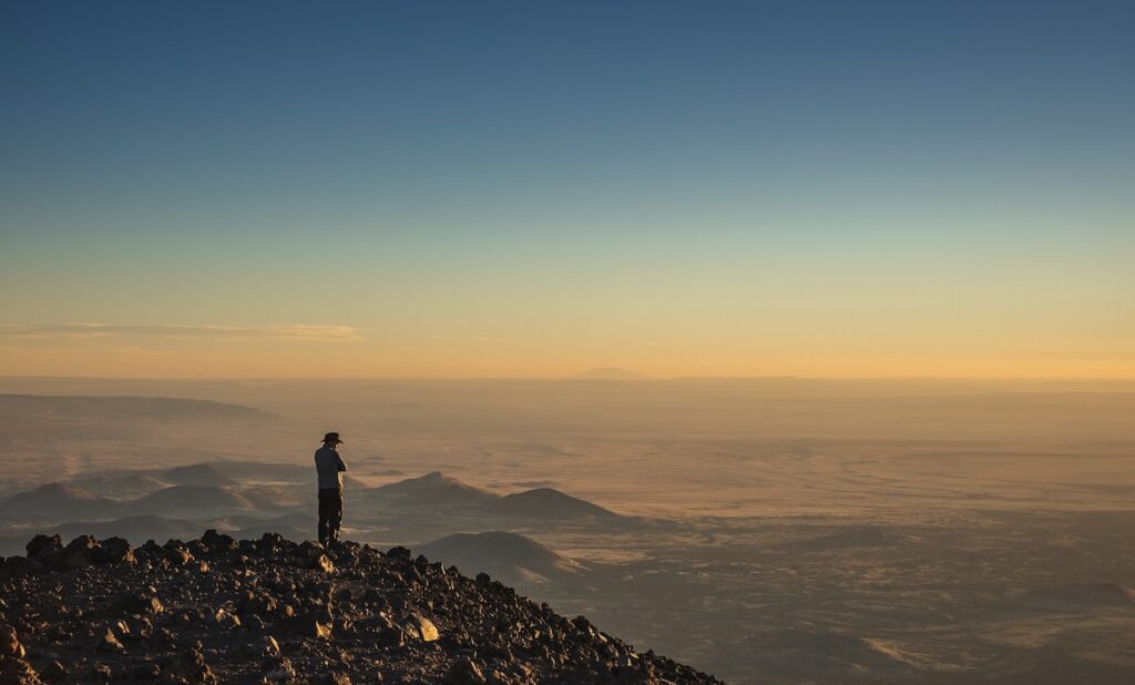
Embark on a thrilling journey through the rugged beauty of Arizona as you conquer the most challenging hikes in the state.
Are you ready to push the limits and experience breathtaking panoramas and diverse landscapes? Strap on your hiking boots, prepare for an adrenaline rush, and immerse yourself in the wild side of Arizona’s great outdoors.
Key takeaways
- Hiking in Arizona is something else! Make sure to pack lots of water (1-2 liters per hour).
- The hardest trails are Superstition Ridgeline, Humphreys Summit, and Nankoweap Trail.
- Flatiron is a great hike! Challenging enough but not too hard
What people say on Reddit
Id like to consider myself an experienced hiker, and Flatiron was one of if not the most difficult trails I’ve ever hiked in my life. My knees are destroyed, but it was worth the experience! The last 1/3 of the hike is a scramble / climb on all fours on loose rock and several meter high rock faces. Take your time, be safe, and have fun!!!
outofthemix86
I had spent 4 years down here in college and the guide job was a way to have a little fun doing something I loved before I had to finally grow up and get a “real job”.
There are indeed a ton of trails around Tucson. That’s actually one of the primary reasons that I still live here. I’ve hiked almost every mile of trail around town and there is way more variety than anywhere else. There’s nowhere else that you can hike from Saguaros to pine in a single day.
chultzy
I caught the first of the storm ( ice and snow mix) staying in a cabin up near the national forest the 16th/17th. Both in awe and terrified of driving out that morning up 89 to Flagstaff.
Side note- we started the devils bridge hike the morning of the 16th before the sun was up and had it all to ourselves at sunrise. Do recommend.
nothingnparticular
Just dont be backpacking in the common crossing area near the border and you’ll be fine. Honestly arizona has a wonderful amount of official trails that don’t trespass anywhere but still feel off the beaten path. The app “all trails” has some good results, maps, and difficulty levels.
Not many people (officials or not) will stop you if you aren’t in a suspicious area. Just don’t hike in weird place… aka don’t go further south than bisbee and you’ll be fine
brittdark
Hardest Hikes in Arizona Map
Useful Vieo
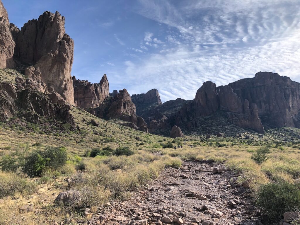
1. Superstition Ridgeline Hike, Phoenix
This challenging day hike requires preparation and endurance. It’s recommended to hike both ends first to familiarize yourself with the area, tackling the Flatiron end and the West Boulder Saddle on the Dacite Super Loop separately.
Both hikes are strenuous, and a car shuttle will be needed to complete the full trail. Hiking from the Flatiron end to Peralta Trailhead provides better shade from the sun, but the route can be completed in either direction.
While not a route-finding nightmare, the hike demands endurance to avoid making mistakes. The northwestern ridge offers beautiful views and several sections of trail marked with rock cairns in indistinct areas.
The hike can be completed without worry of getting lost, as long as you stay within your limits and enjoy the stunning surroundings.
Pro tip This hike shouldn’t be your first experience in the Superstitions Mountains, as it could potentially be your last.
- Difficulty: 5
- Seasons: Feb, Mar, Oct, Nov
- Distance: 11.5 miles
- Accumulated Gain: 4,480 feet
- See on the map
Read also: Best Day Trips from Phoenix, Arizona and 31 Best National Parks & Monuments to Visit in Arizona
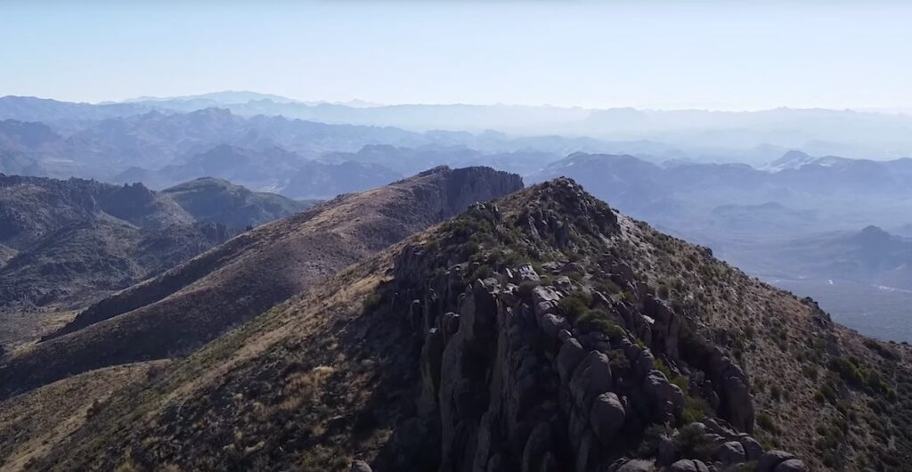
2. Flat Iron, Phoenix
The Flatiron hiking trail, located 40 miles away from Phoenix in Lost Dutchman State Park, offers a challenging yet rewarding experience.
The mysterious Superstition Mountains, formed by intense volcanic activity, feature steep trails that sometimes require short vertical climbs. The halfway point of the hike, known as the Basin, is a natural depression where many hikers decide to turn back. Be prepared with ample hydration and snacks, as the trail is strenuous and lengthy.
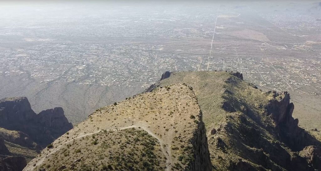
The summit offers a stunning, uninterrupted view of Arizona’s lower desert, making it an ideal spot for resting, taking photos, and enjoying the scenery. Remember to stay cautious and respect the wilderness as you embark on this adventure.
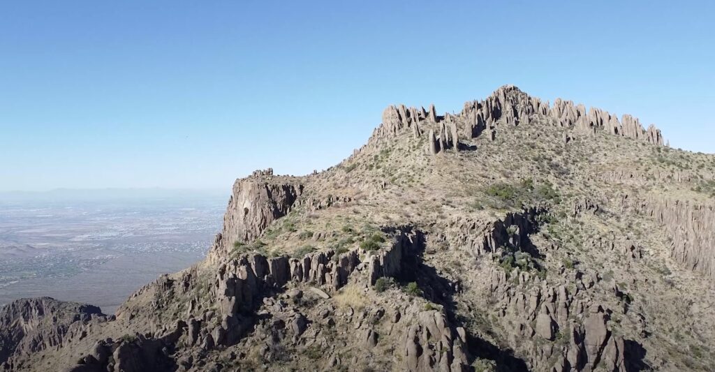
Hiking Flatiron
Starting at the Siphon Draw Trailhead, you’ll pass through the Discovery Trail and enter the Superstition Wilderness. After a mile, the trail turns left, revealing a canyon that appears continuous from a distance.
Hike another quarter mile to the slick rock area, which can be slippery after rain. Continue up the canyon right of the waterfall area, eventually reaching a mini rise with three vertical canyons. Take the far-right canyon to reach the Flatiron, being cautious not to venture into the other two canyons.
Some sections require pulling yourself up, including a nearly vertical ten-foot section. When you reach the ridge, familiarize yourself with the area to avoid disorientation on the way back. Follow the existing trail to the Flatiron’s tip, enjoying the breathtaking views and sheer drop-offs.
Take extra care and concentration when descending, and marvel at your accomplishment once you’re back on solid ground.
Helpful tip I wouldn’t recommend hiking Flat Iron in summer because it requires ample water supply and enormous endurance.
- Difficulty: 4.5
- Seasons: Late Autumn
- Distance: 5.9 miles
- Accumulated Gain: 2,850 feet
- Avg Time One Way: 3.5-5 hours
- See on the map
Read also: Best Hiking Apps for iPhone
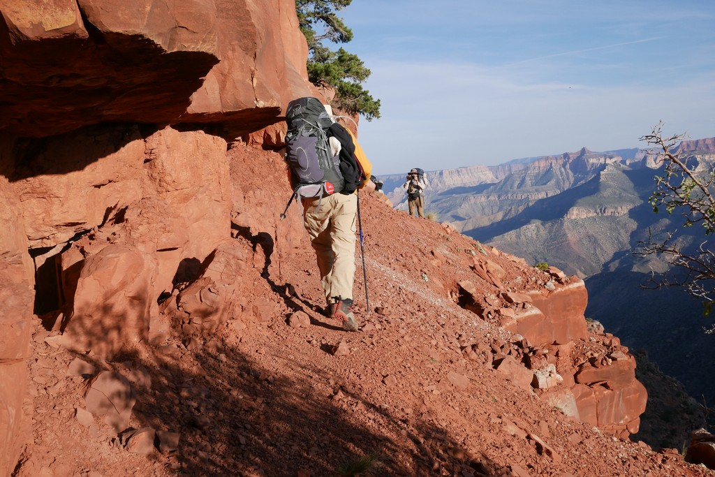
3. Bright Angel Trail, Grand Canyon
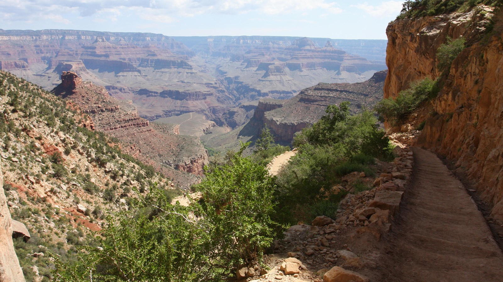
The Bright Angel Trail is a well-maintained, safe trail in Grand Canyon National Park, featuring rest-houses, drinking water, and ranger stations. Following a natural break in the cliffs, the trail has a rich history, including Native American use and early western pioneers. It provides an appealing experience for those interested in geology and wildlife, as it follows a side canyon and offers shade and natural water sources.
The trail’s elevation change occurs mainly in the upper four miles via a series of switchbacks. Indian Garden, an oasis in the canyon, offers a campground and a side trip to Plateau Point. The trail becomes steep again below Indian Garden, with challenging sections like the Devil’s Corkscrew.
Potable water is available at various points, but bringing an alternative form of water treatment is essential.
Hikers must take appropriate precautions depending on seasonal trail conditions, such as starting early in the morning during hot weather or using crampons and hiking poles in icy conditions.
Helpful tip The Grand Canyon is a location defined by its extremes. Although the Bright Angel Trail has been designed with visitor safety as a priority, appropriate precautions are necessary due to seasonal extremes. For example, during winter, the top two miles of the trail can be icy for weeks, making it essential to use in-step crampons and hiking poles.
- Difficulty: 4.5
- Preferred months: Mar, Apr, Sep, Oct
- Distance: 7.5 miles
- Accumulated Gain: 6,820 feet
- Avg Time One Way: 3.5-5 hours
- See on the map
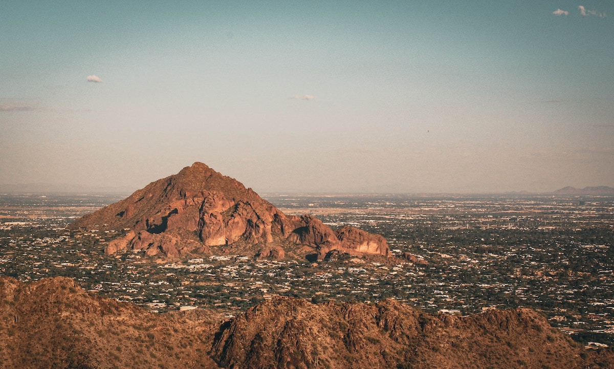
4. Browns Peak (Four Peaks) Trail
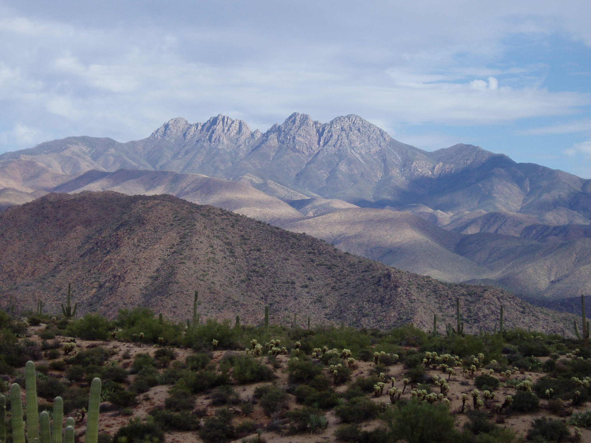
Browns Trail starts with a moderate incline through a lush forest, eventually entering a burn area. As you continue, enjoy the eastern views of Tonto Basin and Roosevelt Lake. After connecting with Amethyst Trail #253, reach Brown’s Saddle, which offers views of the Valley of the Sun and the Superstition Wilderness.
Brown’s Peak, the highest of the four peaks, can be accessed from the saddle. Beware of the challenging and dangerous scree chute leading to the peak, only attempt this section in warm weather and with a friend. After scaling a small wall and reaching a tiny saddle, a more evident trail leads to the summit.
At the peak, enjoy the presence of butterflies and ladybugs, and marvel at the expansive view of the surrounding area, including the San Francisco Peaks on clear days.
Overall, Brown’s Peak offers a thrilling and rewarding hiking experience!
- Difficulty: 4
- Seasons: Late Spring to Autumn
- Distance: 5.2 miles
- Accumulated Gain: 5,700 feet
- Avg Time Round Trip: 3.5 hours
- See on the map
5. Camelback Summit to Echo Canyon Trail
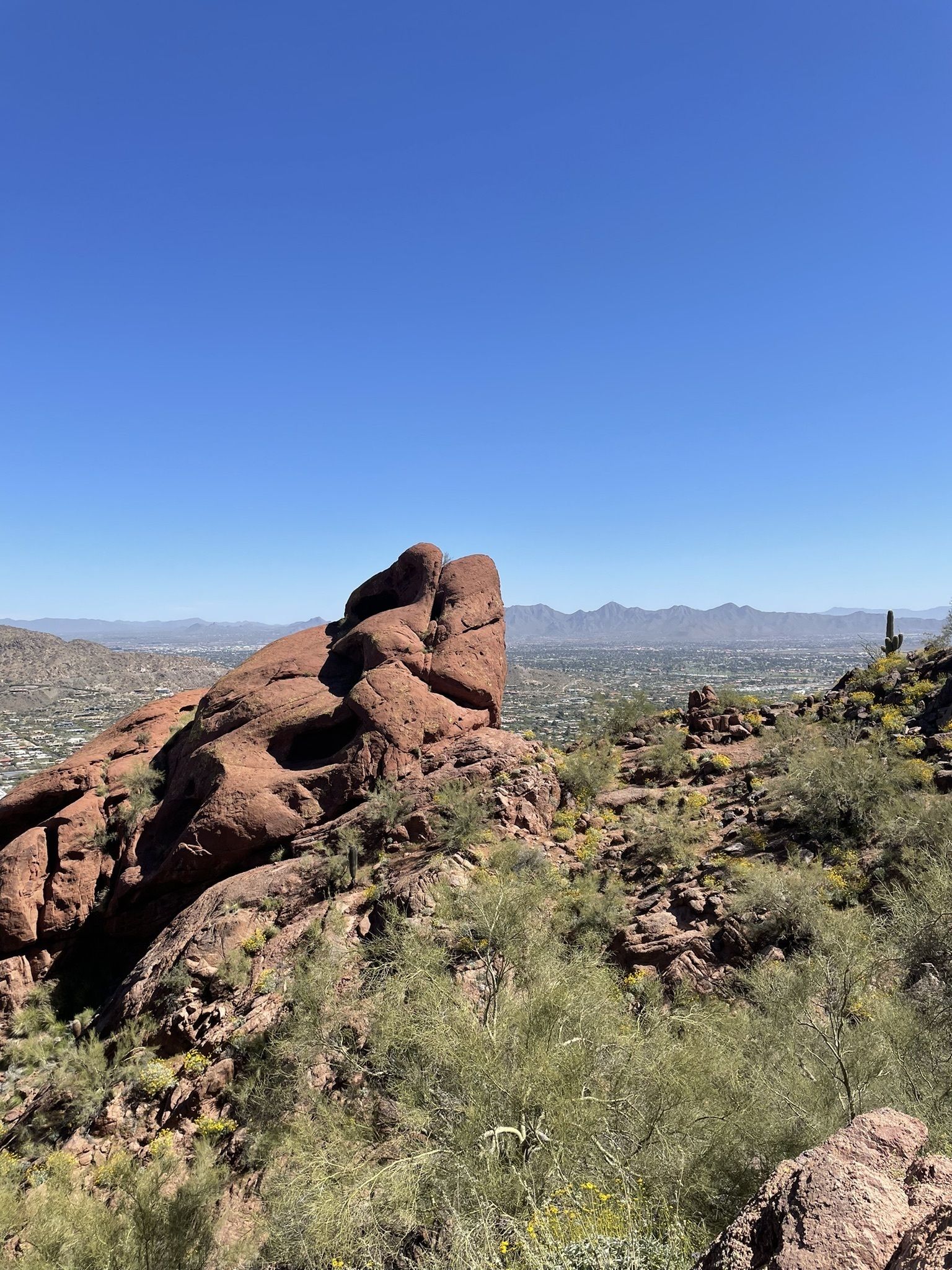
Camelback, a hiking jewel located between Valley cities, offers a convenient yet challenging hike (come prepared for hot weather).
The Echo Canyon Summit Trail, often compared to Piestewa Peak Summit Trail, has large boulders and less-defined sections. The trail’s 2014 reroute leads up to the first saddle, offering beautiful views to the east.
A steep gully follows, leading to a peaceful valley with loose gravel, nicknamed “Ball Bearings.” After zig-zags and boulder-lined gullies, the summit offers spectacular views of mountains and mountain ranges.
The trail is addictive, with some hikers aiming for speed records, but first-timers typically complete the trail in just under two hours.
- Difficulty: 3.5
- Seasons: Nov, Dec, Feb, Mar
- Distance: 5.2 miles
- Accumulated Gain: 1,458 feet
- Avg Time Round Trip: 1.5-2 hours
- See on the map
6. Nankoweap Trail, Grand Canyon
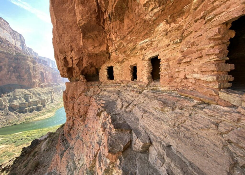
The Nankoweap Trail, known as the most strenuous hike in the Grand Canyon, begins in the cool Aspen groves of the Kaibab National Forest.
The trail includes a series of switchbacks through wooded slopes and a traverse along the red Supai formation. Hikers pass Marion Point, descend down to Nankoweap Creek, and follow it to the Colorado River. The hike to the river is three miles, and there is an optional 750-foot climb to Anasazi granaries.
Due to its difficulty, the trail is not recommended for inexperienced hikers. Also, there is no reliable water source on the trail, and hikers should avoid the sun during the summer. Four or more days are recommended for a more leisurely pace.
- Difficulty: 5
- Seasons: Nov, Dec, Feb, Mar
- Distance: 11 miles
- Accumulated Gain: -4,768 feet
- Avg Time One Way: 5-7 hours
- See on the map
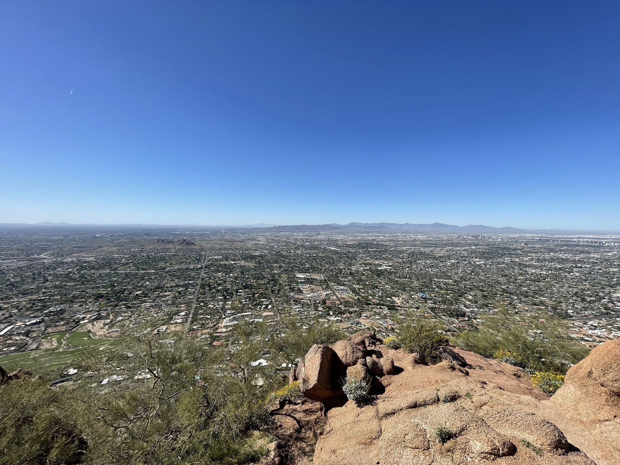
7. Piestewa Peak Summit Trail #300
The Piestewa Peak Summit Trail #300 is a convenient and popular hiking trail near Phoenix, Arizona. The trail, an old horse path, starts with switchbacks and becomes more jagged as it ascends. At the 0.6-mile point, the Circumference Trail branches off, offering an alternative route.
The summit trail features a series of never-ending switchbacks and steep sections before reaching the summit, where hikers enjoy panoramic city views. Camelback Mountain is considered a more challenging hike due to its extra elevation, handrail sections, and boulder fields.
The trailhead offers ample parking and restroom facilities. Rangers frequently patrol the trail, offering assistance and enforcing regulations.
- Difficulty: 3.5
- Preferred: Feb, Mar, Oct, Nov/li>
- Distance: 2.2 miles
- Accumulated Gain: 1,180 feet
- Avg Time One Way: 1.5 hours
- See on the map
8. Humphreys Summit Trail, Flagstaff
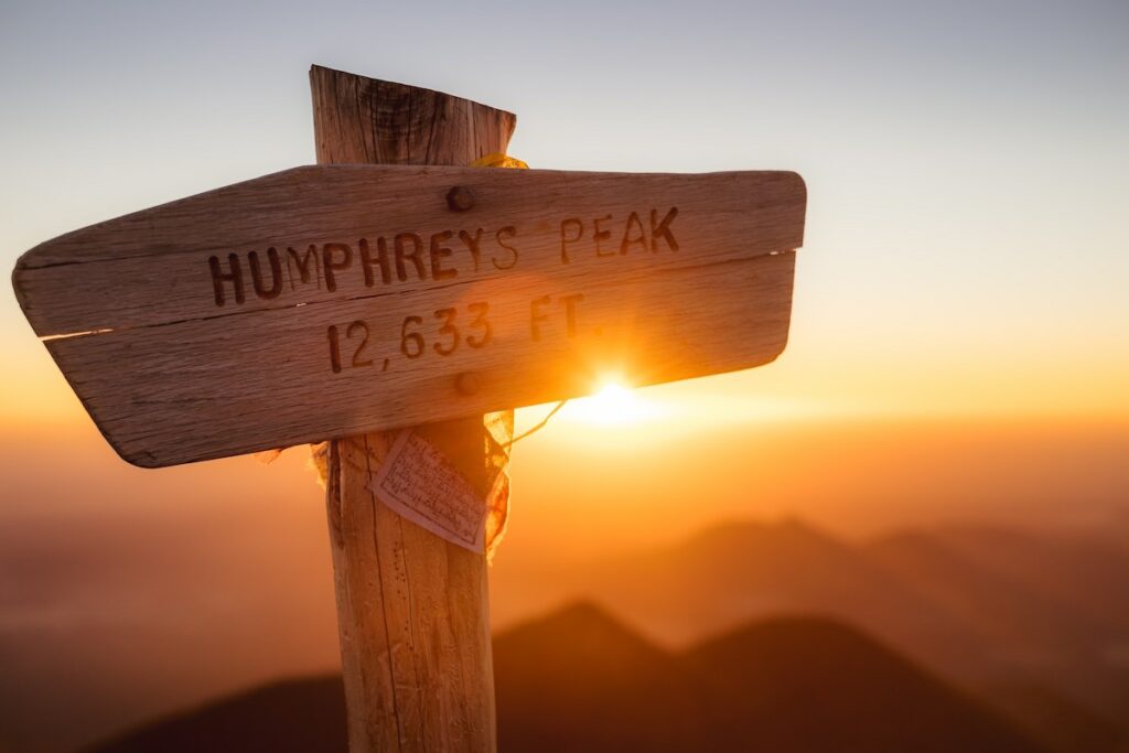
- Difficulty: 4.5
- Preferred: Feb, Mar, Oct, Nov/li>
- Distance: 10.2 miles
- Accumulated Gain: 3,330 feet
- Avg Time Round Trip: 5-6 hours
- See on the map
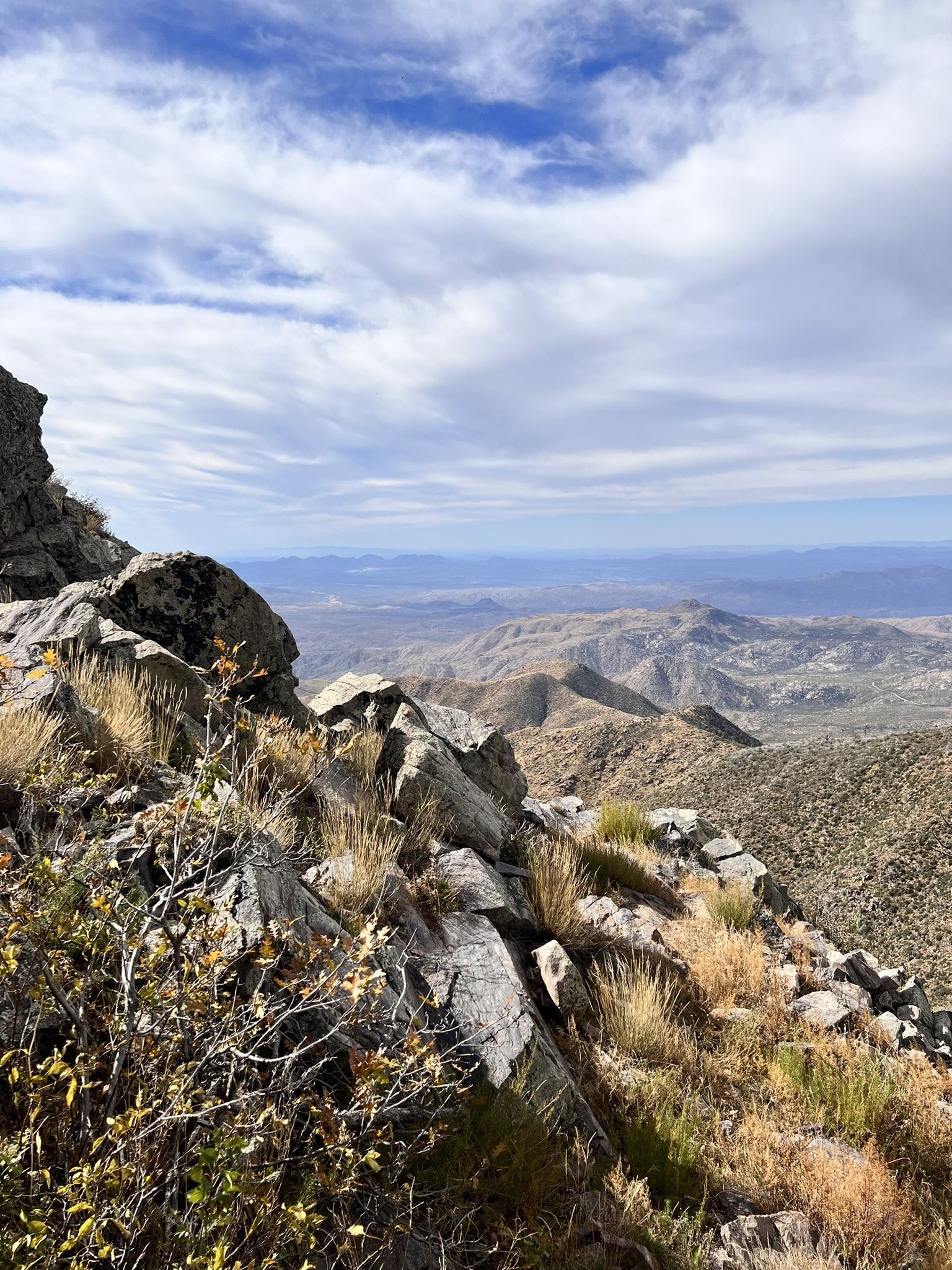
9. The Rattlesnake Trail #275, Tucson
The Rattlesnake Trail in the remote Chiricahua Mountains of southeast Arizona offers solitude for experienced hikers. Closest towns Wilcox and Douglas are both 40 miles away, with no easy access to the area. The trail has suffered damage from fires in 1994 and 2011, making route finding a necessity. The hike starts at the Methodist Camp, following the old FR357 Pine Canyon road for 1.4 miles to reach the Rattlesnake Trailhead. The trail then winds along Rattlesnake Creek, leading to Witch Ridge. From here, it descends into Rock Creek, where it meets the Upper Rock Creek Trail #259.
Though the trail is signed at both ends, signs are in poor condition and the path to Rock Creek is almost non-existent, requiring a complete bushwhack. GPS usage is highly recommended, as the trail is difficult to follow. Views of Barfoot Peak, Chiricahua Crest, and Flys Peak are rewarding for those who brave the challenging terrain. This hike is only suitable for experienced hikers with strong route-finding skills and a willingness to navigate rough terrain.
- Difficulty: 4.5
- Seasons: Late Autumn to Early Spring
- Distance: 2.9 miles
- Accumulated Gain: 727 feet
- Avg Time One Way: 2 hours
- Dogs: no
- See on the map
10. Bear Canyon to Sycamore Dam, Prescott
The Bear Canyon to Sycamore Dam hiking trail offers a challenging off-trail experience for those who enjoy rock scrambling, boulder hopping, and bushwhacking. Beginning at the Bear Canyon Trailhead and ending at the Prison Camp, this hike features a dense, lush wetland area with boulders, pools of water, and large cypress trees.
Expect slow progress as you navigate around pools and downed trees. Near Sycamore Dam, a class 3 scramble leads to the top, offering stunning views of the dam and canyon.
The trail is not recommended for inexperienced off-trail hikers or during wet conditions.
Instagram Review
- Difficulty: 4.0
- Seasons: Late Autumn to Late Spring
- Distance: 1.8 miles
- Accumulated Gain: 496 feet
- Avg Time One Way: 2 hours
- Dogs: no
- See on the map
11. Devils Eye, Young, AZ
The Devils Eye hike in the Sierra Ancha Wilderness is a challenging off-trail adventure that begins at the upper Moody Point Trailhead. Following the Moody Point Trail #140 and turning onto Rim Trail #139, hikers will eventually leave the trail to navigate the peninsula-like land feature dividing the two forks of Devils Chasm.
A steep descent leads to a rock outcropping, followed by a traverse of cliff bands to reach the Devils Window.
This unique natural window offers a stunning perspective of the surrounding area. The hike is not suitable for inexperienced off-trail hikers due to its challenging terrain and navigation requirements. Remember that off-trail travel comes with inherent risks compared to maintained trails.
There is a hike with a similar name – Devils Bridge in Sedona, which is a highly popular easy trail with stunning red rock landscapes.
- Difficulty: 4.0
- Seasons: Apr, May, Sep, Oct
- Distance: 2.8 miles
- Accumulated Gain: 21 feet
- Avg Time One Way: 4-6 hours
- Dogs: no
- See on the map
Useful links
My Other Posts About Arizona
- Explore the White Mountains of Arizona
- Best & Easy Waterfall Hikes in Arizona
- Arizona National Parks
